In the flattest country in Europe, elevation was never the obstacle. Buildings and tree canopy are.
A 30m global elevation model has almost nothing to offer here — the Netherlands barely has elevation to measure. What actually blocks a fixed wireless link is a rooftop, a row of poplars along a canal, a warehouse roof. GridVisio pulls AHN's own 0.5m national surface model automatically — buildings and vegetation included, not bare ground — the finest-resolution source of any country GridVisio supports.
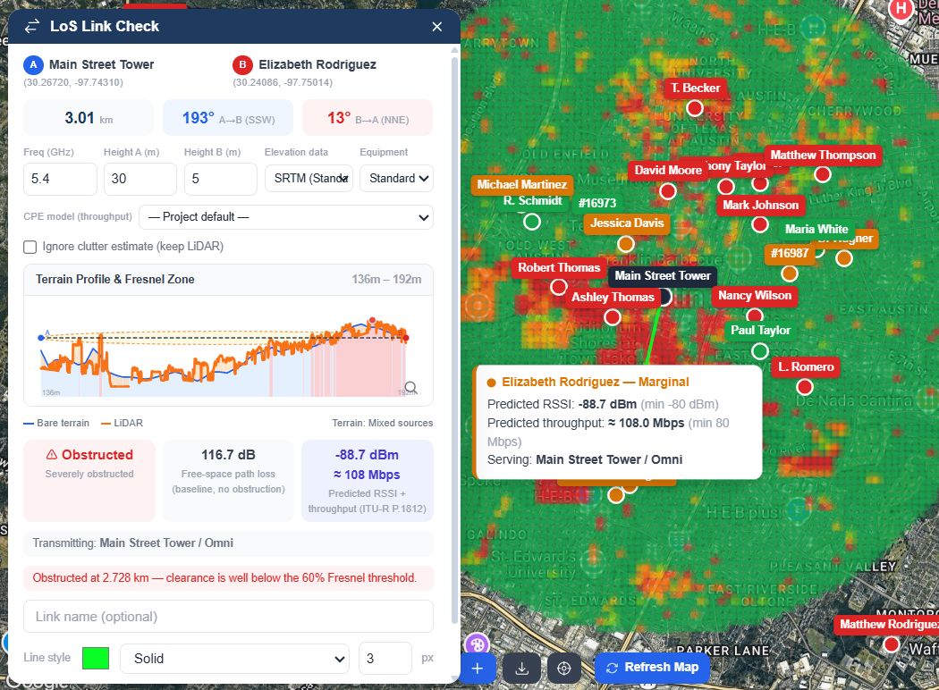
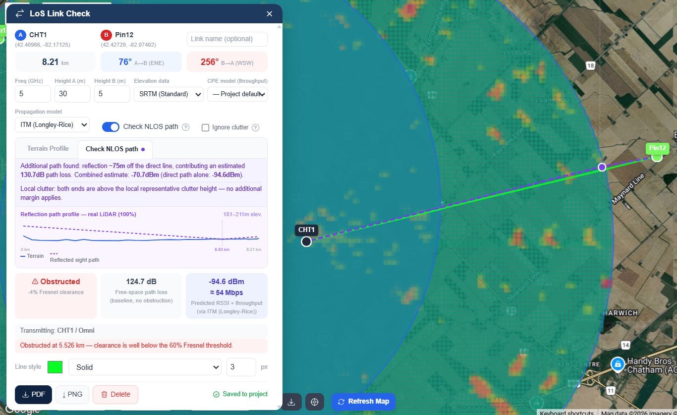
A real link check running on AHN-sourced terrain, not a generic global DEM
Why Dutch WISPs end up here
Not a US tool with an EU checkbox added later. The elevation pipeline, plan limits, and export options were built around what actually blocks a link in a country this flat and this dense.
AHN's 0.5m surface model, not SRTM
Actueel Hoogtebestand Nederland — built from roughly 10 measurements per square metre, originally for dike and water-level monitoring, now covering the entire country — is pulled in automatically at 0.5m resolution. No setting to enable. It's a genuine surface model: rooftops and tree canopy included, not bare ground.
Genuinely complete national coverage
AHN is one of the most mature national elevation programmes anywhere — full coverage for years, with a newer revision (AHN6) already rolling out. No patchy regional gaps to plan around, unlike some countries where a survey is still mid-rollout.
Honest verdicts, not a confident guess
Clear, Borderline, or Obstructed — Borderline is flagged as inconclusive instead of rounded up either way. A rooftop-to-rooftop urban link and a polder-crossing rural one get the same rigour.
Predicted signal, not just geometry
ITU-R P.1812 propagation prediction alongside the Fresnel check, extending to ITM or FSPL+P.526 outside its frequency range — a dBm number and, with a CPE model selected, an estimated Mbps. The same engine drives the RF Heatmap so numbers never contradict each other.
Find where a link would actually clear
Import your own subscriber list and GridVisio clusters unserved or underserved locations by density (DBSCAN), then estimates reach from a hypothetical mast before you commit to a site visit — useful for farmyards and glasshouse clusters just outside the built-up area a fibre rollout already covers.
Coverage widget for your own site
Embed an address-check widget on your website. A visitor's address gets a real LoS check against your nearest masts, not a polygon overlap — so the lead you receive already tells you which site would serve them.
A tree line along a canal blocks a link the same way a hill does elsewhere
The Netherlands doesn't have ridges or valleys to plan around — it has rooftops, greenhouse ranges, and rows of trees along canals and polder edges, often the only thing standing between a mast and a subscriber. A bare-earth elevation model has nothing useful to say about any of that. AHN's surface model does, because it measures the actual built and grown environment, not an idealised flat plane.
On the rare stretch AHN somehow doesn't cover, GridVisio falls back to SRTM 30m automatically rather than refusing to run, and always states which source produced the result you're looking at.
Fresnel clearance computed against a real 0.5m surface model, buildings and canopy included
One coverage map, every layer you actually maintain
Towers and sectors, subscribers, saved LoS links, unserved clusters — all on one map, toggleable by layer. Run an RF Heatmap per sector or per site and see predicted signal strength across your whole footprint, using the same propagation model as the link checker.
Export a clean PDF or PNG of any link check for a customer file, an internal record, or a partner agreement — no extra formatting step, no per-file fee.
RF Heatmap for a sector, driven by the same propagation engine as the LoS checker
Frequently asked questions
Does GridVisio actually cover all of the Netherlands?
Yes — AHN is a complete national dataset, not a partial regional rollout. GridVisio pulls it in automatically at 0.5m resolution wherever a link or heatmap area falls. On the rare failure (a stale tile, a temporary PDOK outage), it falls back to SRTM 30m rather than refusing to run, and the result always states which source it used.
Why does elevation data matter in a country this flat?
Because "elevation model" is a slight misnomer for what actually matters here — AHN is a surface model, meaning it measures rooftops and tree canopy, not just bare ground. In flat terrain, buildings and vegetation are almost always the real obstruction, and a bare-earth dataset would miss them entirely.
With such good existing fibre coverage, why would a WISP operate here at all?
Plenty of real cases: farmyards and glasshouse clusters just outside a fibre rollout's boundary, temporary or fast-turnaround business connectivity, redundant/diverse links for sites that can't tolerate a single point of failure. GridVisio doesn't assume you're filling a nationwide gap — it just checks whether a specific link works.
Is pricing in euros?
Both — USD ($19/month Starter, $39/month Pro) and EUR are available, switchable from your billing page. Both plans include a 14-day free trial with no credit card required to start, and there's also a permanent $0 Free plan with core Starter features included.
Do I need to import my own subscriber and mast data?
Yes — towers, sectors, and subscribers are imported via CSV/XLSX or entered directly on the map. Once they're in, white area detection, reach estimates, and the RF Heatmap all run against your real network, not a sample dataset.
See your own network on real Dutch terrain
14-day free trial — LoS checker, RF heatmap, white area detection, and more. No credit card required.