Find your coverage gaps. Predict real interference before it happens.
GridVisio automatically identifies clusters of unserved subscribers and shows you exactly where to build next. Interference analysis finds sectors that could realistically interfere — co-channel or adjacent-channel, summed across every overlapping sector — and predicts a real carrier-to-interference number using the same terrain-backed propagation engine as the RF Heatmap, not just a shape on a map.
White area detection and interference analysis on a live network
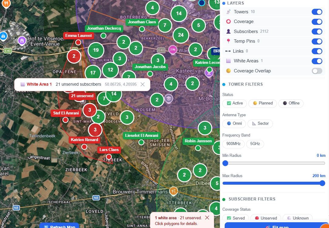
White area detection
Stop guessing where to put your next tower. Let your subscriber data tell you.
DBSCAN clustering — automatically
GridVisio runs DBSCAN (Density-Based Spatial Clustering) on your unserved subscribers. Clusters appear as coloured polygons on the map — each labelled with the count of unserved locations inside.
Click any white area polygon: subscriber count, centroid coordinates, and a shortcut to place a hypothetical tower at the cluster centre to estimate reach instantly.
White areas update automatically whenever you add towers, change sector parameters, or import new subscribers.
White area clusters with unserved subscriber counts
Interference analysis
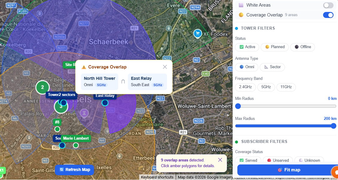
Overlapping co-channel or adjacent-channel sectors can cause real subscriber-facing interference. Find them, and see a real predicted severity — not just a shape on a map — before your subscribers notice.
Co-channel & adjacent-channel detection
GridVisio finds sector pairs whose coverage areas overlap on the same frequency, and — where equipment channel width is known — on spectrally-overlapping adjacent frequencies too, never guessed for unmodeled equipment.
Real predicted C/(I+N), not just geometry
Click a zone and GridVisio computes a real carrier-to-interference-plus-noise number using the same terrain-and-LiDAR-aware propagation engine as the RF Heatmap — every overlapping sector summed, not just the worst pair, with a full contributor breakdown per point.
Worst-first list, not a flat count
A scrollable, severity-sorted list — not just a bubble count — so the zone actually worth checking on a dense network with hundreds of sectors is never lost on the map.
Included in exports
Interference zones and white areas are included in your PDF project report — useful for network reviews and grant documentation.
Interference analysis between overlapping co-channel and adjacent-channel sectors
Plan your next tower with confidence
When you identify a white area, drop a hypothetical tower pin at the cluster centroid. The Reach Estimate panel instantly shows how many unserved subscribers fall within the configured radius and beamwidth — before you spend anything on a site survey.
Adjust radius, azimuth, and beamwidth in real time. When you're confident, promote the hypothetical tower to a real tower with one click — coverage recalculates automatically for all subscribers.
Hypothetical tower reach estimate from a white area cluster
Frequently asked questions
What is white area detection?
DBSCAN (Density-Based Spatial Clustering) runs automatically on your unserved subscribers. The result is a set of polygons showing where groups of unserved subscribers are concentrated — data-driven guidance on where to build next.
How is this different from just looking at the map?
With hundreds or thousands of subscribers, it is impossible to visually identify clusters manually. DBSCAN finds statistically significant clusters based on density — filtering out isolated unserved points that are not worth building for.
What is interference analysis?
It finds sectors from different towers whose coverage areas overlap on the same frequency (co-channel) or on a spectrally-overlapping adjacent frequency (adjacent-channel, where equipment channel width is known) — then, on Pro plans, computes a real predicted carrier-to-interference-plus-noise (C/(I+N)) number for the worst point in each zone, summing every overlapping sector rather than just the closest pair, using the same terrain-aware propagation engine as the RF Heatmap. Co-located sectors on the same tower are excluded — that's a different, near-field problem this analysis doesn't cover.
Does this work with imported subscribers?
Yes. Import via CSV or XLSX. GridVisio classifies each subscriber as served or unserved, then runs white area detection on the unserved subset automatically.
What plan do I need?
White area detection and the base interference zone list are available on Starter ($19/month) and Pro ($39/month). The real predicted C/(I+N) severity number requires Pro. The 14-day free trial includes full Pro-tier access — no credit card required.
Find your coverage gaps today
Import your subscriber list, add your towers, and white area detection runs automatically. 14-day trial, no credit card.