FCC BDC & Form 477 export for WISPs — included, no extra fees
Generate FCC Broadband Data Collection (BDC) availability files and Form 477 subscription data directly from your GridVisio coverage map and subscriber list. Included in Starter and Pro — no per-file charge. BEAD grant documentation also included.
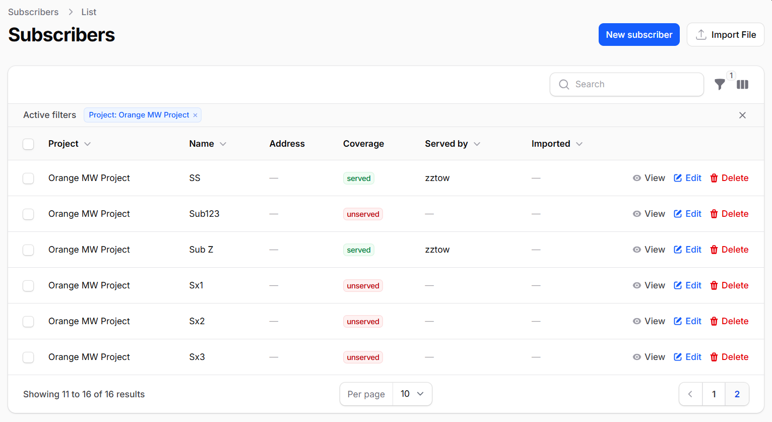
Subscriber list with auto-classification ready for BDC export
2026 FCC BDC Filing Deadlines
Data as of June 30, 2026 → due September 1, 2026
Data as of December 31, 2026 → due March 1, 2027
Form 477 broadband subscription data is now also filed through the BDC system. Missing or materially inaccurate filings carry significant FCC penalties — see below.
What GridVisio generates for you
From your tower and subscriber data to a filing-ready export in minutes.
BDC Availability File
Coverage-area export in the FCC's required format, generated from your tower sectors. Maps your service footprint by census block.
Form 477 Subscription Data
Subscriber counts by census block, technology code, and speed tier — exactly what the BDC system requires for Form 477 subscription reporting.
BEAD Grant Package (ZIP)
A complete BEAD application package: PDF report, location inventory CSV, white-area GeoJSON, and a README — all in one ZIP download.
KMZ Export (GIS)
Full coverage map as a KMZ file for Google Earth, ArcGIS, QGIS, or any GIS tool. Towers, sectors, and subscriber locations included.
BEAD export, rebuilt as a 4-file package
One click generates a ZIP with everything a BEAD application needs — including automatic, per-location terrain and signal verification, no separate step to run.
Executive Summary PDF
Applicant details, network summary (towers, sectors, coverage radii, frequency bands), unserved-location cluster map, tower table, and a BEAD readiness checklist.
Location Inventory CSV
Every location in your export area, with its cluster ID and terrain verification status, plus — on Pro or trial — predicted RSSI, throughput, and an FCC downlink classification (unserved/underserved/served against the 25/100 Mbps lines).
White-Areas GeoJSON
Unserved-area cluster polygons (DBSCAN-clustered) as a standard GeoJSON FeatureCollection, ready for any GIS tool.
Automatic terrain verification
Every export runs a real terrain/line-of-sight check for each location in scope automatically — confirming unserved claims are genuinely unreachable, not just outside a drawn sector. No manual step, no subscriber cap.
Filing-ready in four steps
1. Add your towers. Place towers on the map and configure each sector — azimuth, beamwidth, radius, frequency, technology type.
2. Import subscribers. Upload your subscriber list via CSV or XLSX. GridVisio auto-classifies each as served or unserved.
3. Generate export. Click Export → BDC. GridVisio builds the required file format from your live data.
4. Submit to FCC. Upload the generated file to the FCC BDC portal. Done — no per-file charge.
Cost of non-compliance
$15,000 base forfeiture per violation for materially inaccurate BDC filings (DA 22-639; 47 CFR §1.7009(c)). Continuing violations up to $24,496/day, max $183,718 (DA 24-845).
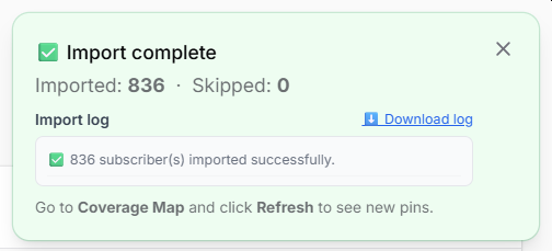
Import log showing served/unserved classification
Frequently asked questions
Is FCC Form 477 still required in 2026?
The broadband deployment portion of Form 477 was sunset in December 2022. However, Form 477 broadband subscription data is still required and is now filed through the FCC BDC system. GridVisio generates both availability (coverage) and subscription data files.
When are BDC filings due in 2026?
Data as of June 30, 2026 is due September 1, 2026. Data as of December 31, 2026 is due March 1, 2027.
Does GridVisio charge per BDC export?
No. BDC, BEAD, KMZ, CSV, XLSX, PDF, and PNG exports are all included in Starter or Pro. One flat monthly fee — no per-file charges.
What plan do I need?
BDC and BEAD exports are available on Starter ($19/month) and Pro ($39/month). Start with a 14-day free trial — no credit card required.
Does GridVisio verify terrain/line-of-sight before including a location as unserved?
Yes, automatically, every time you export — no separate step to remember or run. Generating a BEAD package builds in the background (a small progress indicator shows it working) and checks real terrain/line-of-sight for every location in your export area, confirming a location is genuinely unreachable due to terrain, not just outside a drawn coverage sector — useful supporting evidence for a grant application. On Pro or trial, the same pass also predicts signal strength and throughput per location.
Can I export BEAD data for just part of my network?
Yes. Draw a custom area directly on the map and the BEAD package — CSV, PDF, and white-area GeoJSON alike — is limited to subscriber locations inside it, useful for filing a single county or service area separately. Leave it on Full Project and nothing changes from the default behavior.
Don't miss the September 1 deadline
Data as of June 30, 2026 is due to the FCC on September 1, 2026. Import your network and generate the BDC export in minutes.